- Wet Tropics Management
- Legislative framework
- Management partnerships
- Sustainable Tourism Plan
- Threats to the Area
- Research and a Learning Landscape
- How can I help?
The Wet Tropics of Queensland World Heritage Area is a very special place. Here you can find a collection of facts and figures about its size, history, management, climate and the wonderful plants and animals that live there.

A 2007 survey showed 92% community support for the World Heritage Area and 67% support for Aboriginal cultural listing of the Area. People said that they mainly appreciated the Area for its contribution to their quality of life and for enhancing their environmental awareness.
Listing |
Date |
| World Heritage listing for four natural criteria | 9 December 1988 |
| National Heritage listing for five natural criteria | 21 May 2007 |
| National Heritage listing for Indigenous heritage values | 9 November 2012 |
| Area of the WHA | 894,516ha (0.12% of Australia ) |
| Area of the WT Bioregion | 1,998,790ha (0.26% of Australia) |
| Length of the WHA | Approximately 420km (between Cooktown and Townsville) |
| Perimeter of the WHA | Approximately 3,000km |
| Sections of the WHA | Fourteen separate sections as part of a serial nomination |

Bellenden Ker is recognised as the wettest place in Australia. In 2000 the weather station at the summit recorded 12,461mm of rain. The average is 8,140mm each year (over the past 38 years). On 4-5 January 1979 The weather station recorded a 48 hour total of 1,947mm.
At lower elevations, Topaz has an average annual rainfall of 4,423mm over 31 years and Babinda 4,287mm over 100 years.
Reference: ABS Yearbook 2012
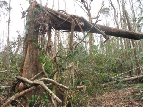
Severe cyclones are a natural part of living in the Wet Tropics and they can have a huge impact, not just on local residents and infrastructure, but on the rainforests and wildlife. Recent cyclones in the Wet Tropics include:
| Cyclone Kirrily | February 2024 |
| Cyclone Jasper | December 2023 |
| Cyclone Ita | April 2014 |
| Cyclone Yasi | February 2011 |
| Cyclone Larry | March 2006 |
| Cyclone Rona | February 1999 |
| Cyclone Winifred | February 1986 |
The Bureau of Meteorology site also reports on other large cyclones in the Wet Tropics such as one at Cape Tribulation in 1934 with a 9.1m storm surge, another in 1927 just north of Cairns and one at Innisfail in 1918, regarded as the worst to hit a populated area of Queensland. It destroyed all but 12 houses with Mission Beach covered by 3.6m of water. See the Bureau's website for previous cyclone information and some history of major cyclones in the past.
Bartle Frere and Bellenden Ker, found in the Wet Tropics, are the two highest mountains in Queensland. The highest named peaks in the Wet Tropics are (excluding some multiple peaks):

| 1 | Bartle Frere South Peak | 1,622m |
| 2 | Bellenden Ker Centre Peak | 1,593m |
| 3 | Mount Fisher | 1,385m |
| 4 | Thornton Peak | 1,374m |
| 5 | Black Mountain | 1,337m |
| 6 | Roots Mount | 1,331m |
| 7 | Devils Thumb | 1,330m |
| 8 | Mount Spurgeon | 1,322m |
| 9 | Lambs Head | 1,306m |
| 10 | Mount Haig | 1,261m |
| 11 | Mount Massey | 1,258m |
| 12 | Mount Misery | 1,246m |
| 13 | Mount Lewis | 1,224m |
The mountains of the Wet Tropics are the northern extent of the Great Dividing Range and the source of numerous major river catchments. The majority eventually flow east to the Coral Sea, but the Mitchell River flows west to the Gulf of Carpentaria. There are also many smaller coastal catchments. Major catchments include (north to south):
-5.jpg)
| Annan River | Russell River |
| Bloomfield River | North and South Johnstone Rivers |
| Normanby River | Hull River |
| Daintree River | Tully River |
| Michell River | Murray River |
| Mossman River | Herbert River |
| Barron River | Burdekin River |
| Mulgrave River |
Waterfalls
Wallaman Falls, west of Ingham, is 305m high, the longest single drop waterfall in Australia.
Other major waterfalls within the World Heritage Area with easy road or walking track access include Roaring Meg Falls, Wujal Wujal (Bloomfield) Falls, Crystal Cascades, Barron Falls, Kearneys Falls, Josephine Falls, Nandroya Falls, Wallicher falls, Tchupala Falls, Tully Falls, Murray Falls and Jourama Falls. See the walks section for more details.

The Wet Tropics is home to a rich diversity of plants and animals, including at least 663 species of vertebrate animals, 230 butterfly species, 135 dung beetle species and 222 species of land snails.
The World Heritage Area contains about 2,800 vascular plant species - 700 found nowhere else in the world! The Bioregion has over 4,000 plants species. Sixteen out of the world's 28 lineages of primitive flowering plants grow in the Wet Tropics and within these families, there are at least 50 flowering plant species found nowhere else.
The Wet Tropics has 47 animal species and 227 plant species listed as threatened. You can read the details on the threatened species page.
The Bioregion contains the following percentages of Australia's animals and plants:
Animals |
% |
Plants |
% |
|
| Marsupials | 30 | Ferns | 65 | |
| Bats | 58 | Cycads | 21 | |
| Mammals | 30 | Conifers | 37 | |
| Birds | 40 | Orchids | 30 | |
| Frogs | 29 | Vascular plants | 26 | |
| Reptiles | 20 | |||
| Freshwater fish | 42 | |||
| Butterflies | 60 | |||
| Rodents | 25 |

The Wet Tropics Vegetation Mapping has identified eight major vegetation types throughout the bioregion. These are listed below with percentage area covered for both the World Heritage Area and the Bioregion.
Vegetation type |
% WHA |
% Bioregion |
| Rainforest | 66.51 | 34.13 |
| Sclerophyll and sclerophyll rainforest transitions | 4.80 | 2.67 |
| Sclerophyll forests and woodlands | 24.50 | 34.42 |
| Mangrove community complex | 1.70 | 2.50 |
| Shrubs and heathlands | 0.15 | 0.49 |
| Vegetation complex and mosaics | 1.23 | 3.41 |
| Non-woody vegetation | 0.03 | 0.15 |
| Unvegetated, cleared land and water bodies | 1.08 | 22.23 |
Regional Ecosystems: The Wet Tropics Bioregion contains 185 Regional Ecosystems (18 endangered, 134 of concern).
Over 500 weed species have become naturalised in the Wet Tropics. You can find a list of them here.
There are at least 20 Rainforest Aboriginal tribal groups who have land and cultural connections within the Wet Tropics World Heritage Area:

| Bandjin | Ma:Mu |
| Djabugay | Mbarbarun |
| Djiru | Ngadjon-Jii |
| Eastern Kuku Yalanji | Nywaigi |
| Girramay | Warrgamay |
| Gugu Badhun | Warungnu |
| Gulnay | Western Kuku Yalanji |
| Gunggandji | Wulgurukaba |
| Jirrbal | Yidinji |
| Koko Muluridji | Yirrganydji |
Eleven local governments areas (LGAs) have land in the Wet Tropics World Heritage Area. You can see local government areas on this map page.
![Scenic View Atherton Tableland [Portrait] Scenic View Atherton Tableland [Portrait]](https://www.wettropics.gov.au/site/user-assets/mcms_cb_resized/scenic-view-atherton-tablelands-portrait-2.jpg)
Local government |
% LGA in WHA |
% WHA in LGA |
| Cairns Regional Council | 52.4 | 9.8 |
| Cassowary Coast Regional Council | 48.4 | 25.2 |
| Cook Shire Council | 1.1 | 5.0 |
| Charters Towers Shire Council | 1.1 | 3.5 |
| Douglas Shire Council | 80.7 | 21.8 |
| Hinchinbrook Shire Council | 18.7 | 5.8 |
| Mareeba Shire Council | 1.4 | 8.1 |
| Tablelands Regional Council | 13.6 | 17.1 |
| Townsville City Council | 6.7 | 2.8 |
| Wujal Wujal Aboriginal Shire Council | 80.0 | 0.1 |
| Yarrabah Aboriginal Shire Council | 45.7 | 0.8 |
The following table lists the percentage areas for ten categories of base tenure within the World Heritage Area (last updated in December 2013). Leasehold shown in table below is that of base tenure only. Please note that strata tenure (often leases) sits predominantly over national park and timber reserve and comprise 3.5% of the Area. You can see various tenure maps on this map page.

Tenure |
% WHA |
| National Park | 85.76 |
| Forest Reserve | 0.89 |
| State Forest | 0.68 |
| Timber Reserve | 0.05 |
| Various Reserves | 0.78 |
| Leasehold Base Parcel | 1.5 |
| Unallocated State Land | 1.7 |
| Freehold and similar | 7.3 |
| Commonwealth Acquisition | 0.17 |
| Roads, esplanades and rivers | 1.17 |
There are dozens of national parks with all or some of their lands within the World Heritage Area. The first national parks in the region were Bellenden Ker in 1921 (now part of Wooroonooran NP), Hinchinbrook Island in 1932 and Lake Barrine and Lake Eacham in 1934 (now Crater Lakes NP). Since the time of listing in 1988, protected area estate (i.e. national parks, conservation parks, state forests and forest reserves) within the Area increased from 14% to about 85% in December 2013, and is now around 87% (as of 2025).
 Tourism and recreation and economics
Tourism and recreation in the Wet Tropics play an important role in community use and enjoyment and helps educate locals and visitors about the Area's Outstanding Universal Value. Tourism and recreation also contribute substantially to the region's economy.
The Wet Tropics World Heritage Area and surrounds contain:
Tourism and recreation in the Wet Tropics attracts five million visitors to the Area annually, and directly contributes $426M annually to the regional economy.
The collective worth of the Wet Tropics World Heritage Area’s natural assets—including tourism, cultural and environmental values—is likely to exceed $5.2 billion (Wet Tropics Management Authority State of Wet Tropics Report 2014-15).
In 2008 the Australian Government commissioned a report on The Economic Activity of Australia's World Heritage Areas. The Wet Tropics of Queensland creates the greatest economic benefit of Australia's natural properties (see summary report here - the Great Barrier Reef was not included in the analysis).
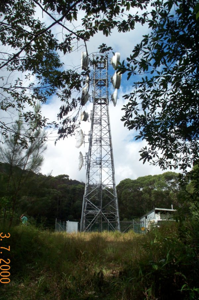
 The World Heritage Area plays a vital role in the community and incorporates a range of community services infrastructure. Infrastructure within the Area includes:
Electricity
Water
Other
See State of the Wet Tropics 2008-2009 for more details on infrastructure within the Area (some figures here have been updated).